
Keelogyboy Mountain [Sliabh na gCaolog Bui]
Good walks are even better shared.
Overview
Keelogyboy Mountain [Sliabh na gCaolog Bui]
Introduction
Keelogyboy Mountain, standing at an elevation of 505 meters, is a delightful spot for hiking enthusiasts and nature lovers alike. Nestled in the picturesque Cuilcagh Mountains of County Fermanagh, it offers a little bit of everything: gentle slopes, captivating views, and a touch of whimsy in its name.
Geology
Primarily made up of ancient sandstone and mudstone from the Devonian period, the geology of Keelogyboy tells an age-old story of shifting landscapes and is a playground for rock enthusiasts.
Routes
One of the most popular routes is the Keelogyboy Circuit, a moderate 12-kilometer loop that takes about four hours to complete. Starting at St. Patrick's Church, you will meander through lush hills and gaze out over the striking landscape. Just watch out for unexpected mud puddles — they can surprise you like a rogue sheep!
Summit Features
The summit features a small stone cairn that is ideal for a quick rest or a celebratory selfie. The views from the top? Breathtaking! You’ll want to take a moment to absorb them before your descent.
Terrain
The terrain ranges from grassy hills to rocky outcrops, with some lovely bogginess thrown in for character. Proper hiking boots are essential unless your idea of fun is squelching through mud.
Views
Keelogyboy offers fantastic views of the surrounding mountains, particularly Cuilcagh, as well as the expansive Lough Erne. The best time to take in these sights is during the autumn months, when the foliage transforms into a canvas of vibrant colours, or during spring when wildflowers paint the hillsides.
Hazards
As with any hike, there are a few hazards to keep in mind. The trails can be slippery after rain, and unpredictable weather is not uncommon. Dress in layers, and perhaps leave your best shoes at home unless you fancy a mud bath!
Access
Nearest Parking: There is a public parking area at St. Patrick's Church in Cavanaleck, which is very convenient for starting your hike.
Public Transport: Buses operate from Enniskillen, but they are somewhat whimsical in their timeliness.
Nearest Town: Derrygonnelly is the closest town, providing local amenities and a spot to celebrate your summit with a refreshing pint.
Facilities
While facilities near Keelogyboy are minimal, the cafes and shops in Derrygonnelly offer a good selection for pre/post-hike snacks. There are public toilets available by the church for those in need of a quick stop.
History
Name Meaning
Sliabh na gCaolog Bui means 'the mountain of the yellow streams'. It’s a fitting name for this location, given the streams that grace the mountain landscape with their gentle flow.
Significance
Beyond its stunning views, Keelogyboy is a cherished symbol of the Fermanagh landscape and embodies the area's rich cultural heritage.
Conclusion
Whether you're looking to stretch your legs, soak in some stunning views, or just laugh at how much mud can stick to your boots, Keelogyboy Mountain has it all. Get out there and enjoy!
Explore routes near Keelogyboy Mountain [Sliabh na gCaolog Bui]
Public walks starting within 80 km of this hill. Nearby does not mean a route reaches the summit; check its map and access before setting out.
Route planning notes
These notes describe possible approaches, not verified navigable routes or permission to cross land. Check current paths, local access rules and conditions before setting out.
Keelogyboy Circuit
A scenic loop starting from the nearby St. Patrick's Church, winding through the rolling hills and offering stunning views on the ascent.
Make a day of it, together
Find someone to share the walk with, or organise a day out along a route you like.
Hill facts and local notes
Classifications
Elevation
438m
1,437 ft
Prominence
146m
Coordinates
54.2993, -8.3525
G771390
OS Map
16 25
At the Summit
At the summit, hikers will find a modest stone cairn that offers a perfect spot for a photo op or a cheeky snack break. No views are permitted from the summit, just kidding – it has one of the best panoramic views around!
Terrain & Geology
Keelogyboy Mountain is primarily composed of sandstone and mudstone, which were formed during the Devonian period. The area's geology speaks to the ancient history of this stunning landscape.
Views & Scenery
On a clear day, you can see the rugged peaks of the Cuilcagh range and the glistening Lough Erne in the distance, not to mention new heights of your own contemplating just how you got there.
History & Heritage
Name Origin
The name 'Sliabh na gCaolog Bui' translates to 'the mountain of the yellow streams', a nod to the streams that meander through its lush valleys.
Historical Significance
This mountain is steeped in local legend and is a popular symbol of the rugged beauty of the Fermanagh region, fostering a deep connection with the region's culture and history.
Getting There & Facilities
Check current local access restrictions, parking rules and transport timetables before travelling. These notes do not confirm public access to the summit.
Parking
You can park at the public parking area near St. Patrick's Church in the village of Cavanaleck, which provides access to trailheads leading toward Keelogyboy.
Public Transport
Buses run from Enniskillen to the nearby villages, but you may need to check the current schedule for reliability, as the buses are known to keep their own hours.
Nearby Facilities
Facilities are minimal but you'll find a couple of cafes and shops in Derrygonnelly, and public toilets are available near the church area.
Safety Information
Known Hazards
- Muddy paths can be slippery after rain; watch your step! Also, sudden weather changes may catch you off guard, so dress in layers and be ready for anything, including unexpected visits from overzealous sheep.
General Safety Tips
- Check weather conditions before setting out
- Carry appropriate clothing and equipment
- Let someone know your planned route
- Take a map, compass, and GPS device
- Carry emergency supplies: food, water, first aid kit, torch
Hills
Some common questions about the hills answered
Are there group walks up Keelogyboy Mountain [Sliabh na gCaolog Bui]?
Many walkers use Walkmates to join or organise walks with others. You can check for group walks around Keelogyboy Mountain [Sliabh na gCaolog Bui] through the maps
Are there other walkers around Keelogyboy Mountain [Sliabh na gCaolog Bui]?
Activity varies by location and time, but Walkmates lets you see whether others have shared walks or shown interest in this area. Find other people through the walking friends search walking friends for Keelogyboy Mountain [Sliabh na gCaolog Bui] search or of course create your own walk for Keelogyboy Mountain [Sliabh na gCaolog Bui]
Can I organise a walk to Keelogyboy Mountain [Sliabh na gCaolog Bui]?
Yes. If there aren’t any walks listed already, you can create a walk and make it available for others to join.
If you're signed up to Walkmates, you can create a walk to Keelogyboy Mountain [Sliabh na gCaolog Bui].
How do I find a walk up this hill?
There are often multiple ways to walk this hill, depending on experience and route preference. Walkmates helps you explore walks and routes that others have shared.
Can I suggest a new route up Keelogyboy Mountain [Sliabh na gCaolog Bui]?
Yes. You can suggest or create routes to share with others. Walkmates focuses on the social side of walking, so routes are used to help people organise walks and explore areas together, rather than as detailed navigation tools or route libraries.
Other uses really appreciate knowledgeable walkers sharing their routes. Share your favourite route to Keelogyboy Mountain [Sliabh na gCaolog Bui] here
The is an error or something incorrect about this hill. How do I let you know?
We always strive to keep the information on Walkmates as accurate as possible. If you find an error, please let us know through the contact form and we'll aim to correct it as quickly as possible
Community Discussion
Comments
Location
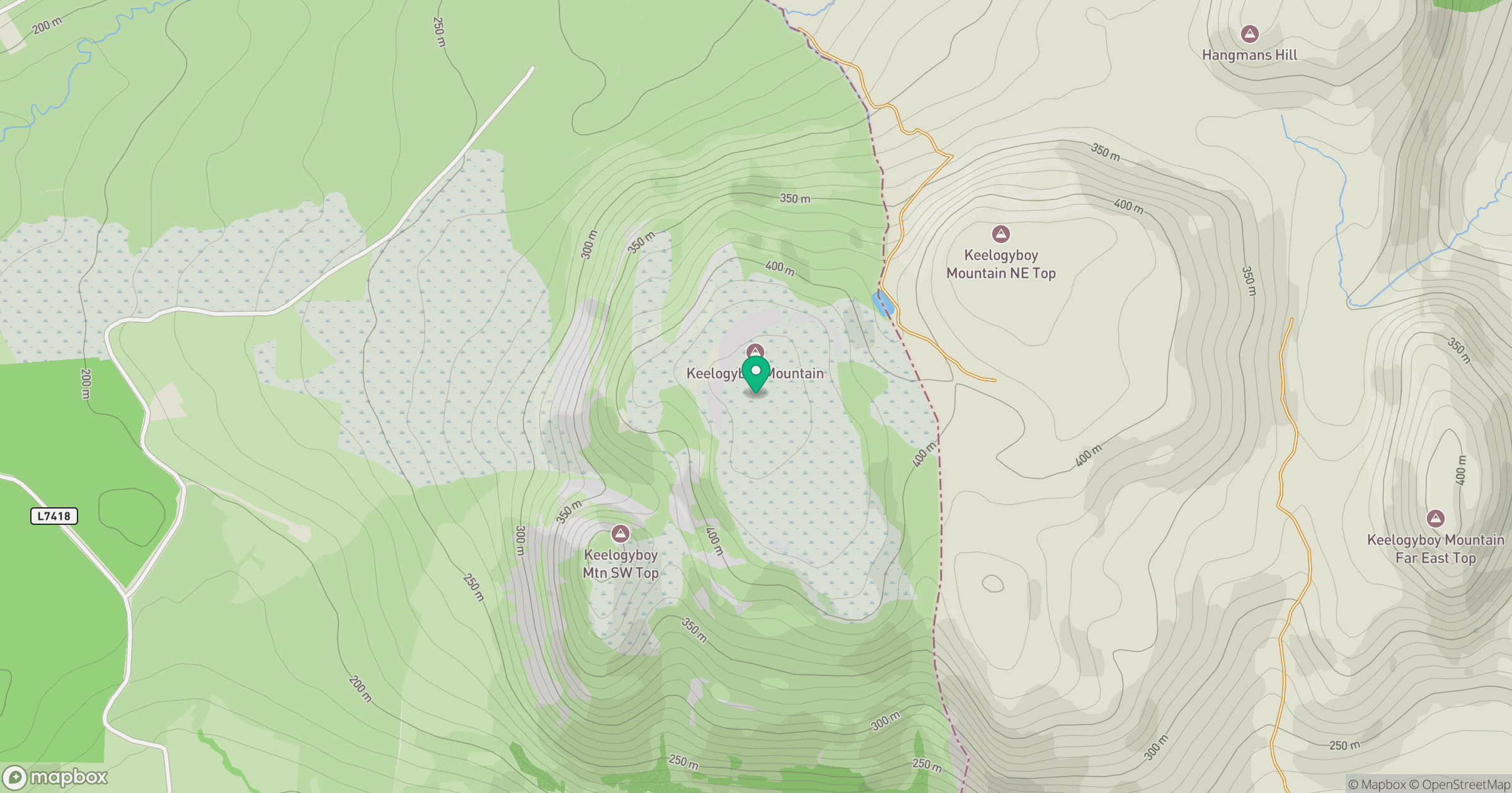
Grid reference: G771390
View on OpenStreetMapOpens a map in a new tab, centred on the hill.
Hills within 30 km
Straight-line distance, not a walking route or confirmation of access.
No comments yet. Be the first.